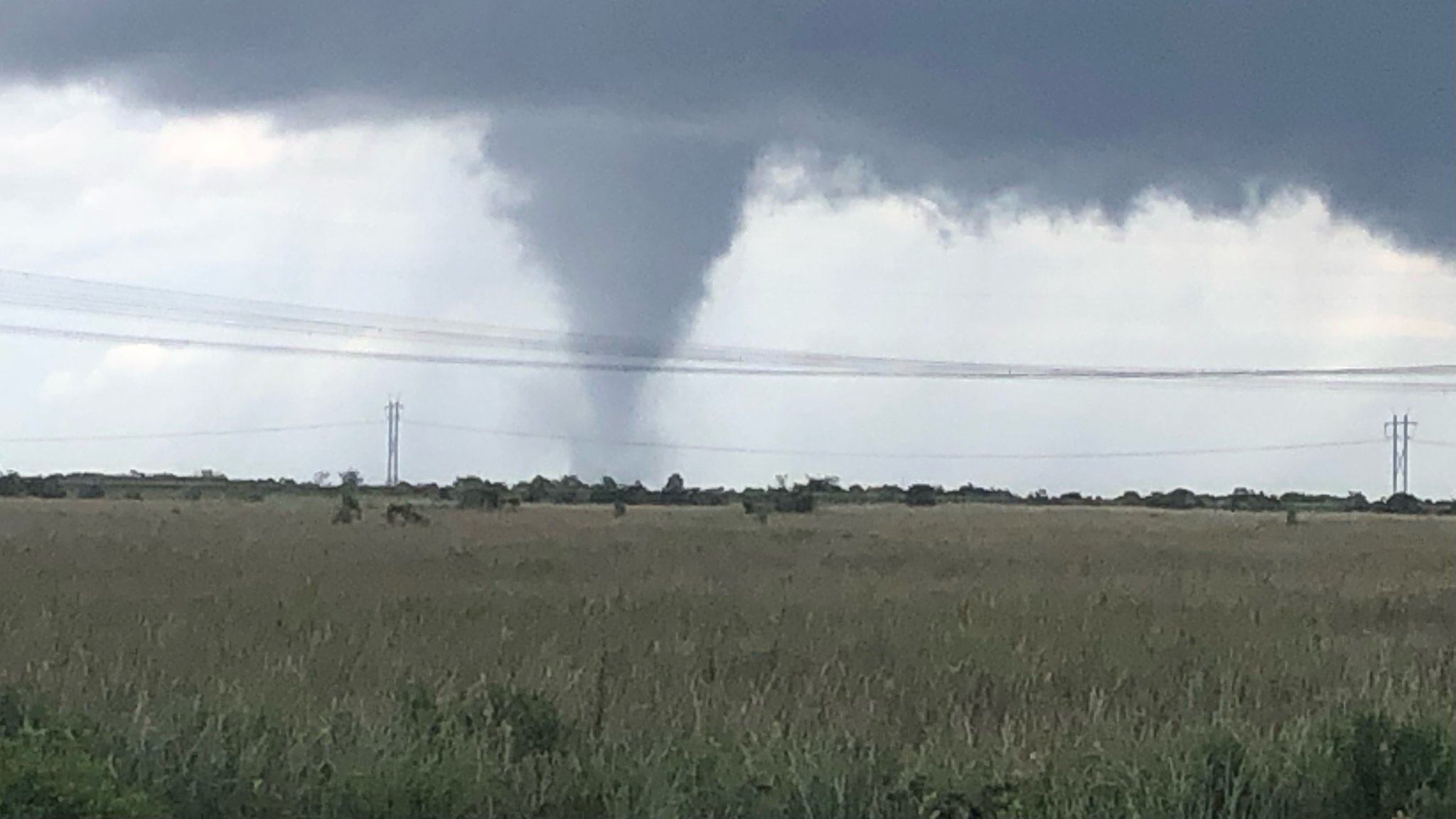
In the last few hours, several tornadoes have been reported on the west coast of Florida associated with the effects of Hurricane Milton, which is expected to arrive near midnight this Wednesday in the Tampa Bay area. The National Weather Service (NWS) in Miami shared several images of these atmospheric phenomena on their social media, which are common in this state during the summer.
The National Meteorological Service confirmed that current weather conditions in the area are favorable for the rapid formation of tornadoes.
PUBLICIDAD
Where have these tornadoes been seen in Florida?
One of the tornadoes was captured crossing I-75 highway near the Big Cypress Seminole reservation. Another one was photographed west of Clewiston in Hendry County, both in southern Florida.
Tornadoes were also reported on social media in Osceola County, south of Orlando.
According to the 2 pm bulletin, Hurricane Milton is located at latitude 26.3 North, 84.0 West, moving North-Northeast at 16mph with a pressure of 944 mb. Its winds are 130 miles per hour.
Meteorologists expect the system to maintain hurricane strength as it crosses the center of Florida on Thursday on a route eastward, towards the Atlantic Ocean.
Thousands of people are fleeing the coast
As Hurricane Milton advances along the Gulf of Mexico coast towards Tampa and St. Petersburg, thousands of people are fleeing the area in search of a safer place, leaving behind the debris and destruction left by Hurricane Helene less than two weeks ago.
Although Milton's classification has fluctuated several times between category 4 and 5, it is expected that the storm will be "an extremely dangerous hurricane" when it makes landfall on Wednesday. The magnitude of the damage will depend on its storm surge, and the number of deaths may depend on how many people heed the evacuation warnings.
According to some specialists, Milton could be the strongest hurricane to hit Tampa since 1921.
